
Walking Artist - Mytho Geography
Many of you who visit Cockington will have noticed the new signage and interpretation around the estate and inside the Court - here we feature 4 walks you can go on that reveal Cockingtons rich and ancient and modern heritage......
Walk 1.....
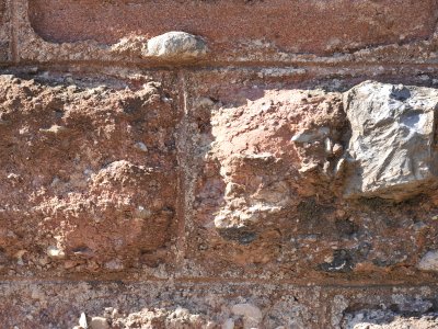
Of a number of possible options there are at least two outstanding routes to follow from Torre Abbey to Cockington. The first begins at Torre Abbey at the coffin stone engraved with the ‘tree of life’ insignia (within the stone of the coffin top fossils of sea creatures are visible); this symbolic pattern includes an ingenious interweaving of four circles in one circle and an arching curve that ends in something like a misshapen arrowhead. The arching image is picked up again in the swan’s necks at the gates to the Abbey. Across the road the remains of a water fountain are crenellated, a reminder of the paranoid and defensive aspect of this coastline subject to fears of invasion. Walking down The King’s Drive, the visitor picks up the water on their right. At first it seems to be trapped in an ornamental concrete channel, but a look and a climb up the grass to the left and there is the original source: the Sherwell. The larger ornamental pool sits today where a more utilitarian freshwater pool stood in the eighteenth century from which the Royal Navy drew clean drinking water for its ships; water that, presumably, then travelled to numerous sea battles and blockades – this pool was maintained by the Mallock family, one assumes at a price to the Navy, but was undermined when the Cary family built a weir upstream in 1750 leading to the drying up of the naval watering hole. Across the Torbay Road is an antique seafront shelter, with an avenue of cast-iron pillars (there are many ‘avenues’ on this route) – T. S. Eliot intended to come to Torquay with his wife who was convalescing from a nervous breakdown. At the last moment they changed their plans and went to Margate, where, in a seafront shelter Eliot wrote most of his famous poem ‘The Wasteland’. So this Torquay shelter is possibly where T. S. Eliot almost wrote ‘The Wasteland’! On the beach is an avenue of beach huts – following their line, and the tide allowing, the visitor can check out the red breccia rocks standing in the water in strange vertical layers. Climbing the path at the end of the beach up to Corbyn’s Head (Saxon: “crooked head”, a head where there was a natural arch until it fell in 1822, a second arch collapsing during a storm in 1936), where an avenue of young trees has replaced the giant elms felled by Dutch Elms Disease, at the end of these the walker can look back, and those layered rocks will now reveal their straight edge – the edge of a former pier. Corbyn’s Head is a key site for the defensive view – here Richard Mallock MP established and maintained his own small artillery crew through the last decades of the nineteenth century and here members of the Home Guard were killed in WW2 while test-firing a piece of Japanese-made artillery. Today, the view often takes in a new source of ‘invasion’ and reason for watchfulness and defence – there are large oil tankers sheltering on the edge of the bay. Following the road round towards Livermead, noting the fabulous combinations of sandstone, breccias and limestones in the walls along Torbay Road. Pass by Livermead Hotel (once Livermead House) where, in the mid-nineteenth century the Christian-Socialist clergyman Reverend Charles Kingsley, author of ‘The Water Babies’, was a long-stay visitor. It was his explorations of the waterline from Livermead to Paignton beach that were the key inspirations and sources for his ‘Glaucus; The Wonders of the Shore’ (1855), a fabulous work of popular science, with curious and engrossing illustrations, and musings on tourism, evolution and the strangeness of deep sea animals. Walk down onto Institute Beach and you enter a wonderland that slowly reveals itself the closer it is examined – the rockpools are still alive with many of the animals that the Rev. Kingsley wrote about and illustrated in ‘Glaucus’. A quick examination of the larger rocks will soon reveal Beekites (first discovered and classified here by a Mr Beek of Bristol) – beautiful green-grey rippled rock (their circular shapes suggestive of the round shapes on the Torre ‘tree of life’) - “(A) concretionary form of calcite or silica that occurs in small rings on the surface of a fossil shell which has weathered out of its matrix”, it is a replacement of lime by silica, a fascinating transition from one pillar of Torbay geology to the other. A strange large round ‘erosion’ in the rock here turns out to be the hole left by workers removing millstones, and the beautifully circular ‘rockpools’ turns out to be a straight line of six beautifully circular ‘rockpools’ (those ‘tree of life’ circles again), post-holes for a large pier constructed here hundreds of years ago (there is an illustration dated 1841 in Brian Read’s ‘Cockington Bygones vol. 1’ that shows a fishing boat apparently tied up to the remnants of this pier). There is so much to discover here, but you drag yourself away and cross back over the Torbay Road and up Cockington Lane, first pausing for a moment before entering the Lane… this is surely the spot that in 1855 is described by Kingsley like this: “rounded hills slope gently to the sea, spotted with squares of emerald grass, and rich red fallow fields, and parks full of stately timbers. Long lines of tall elms run down to the very water’s edge, their boughs unwarped by any blast; here and there apple trees are bending under their loads of fruit, and narrow strips of water-meadow line the glens, where the red cattle are already lounging in richest pastures, within ten yards of the rocky pebble beach”. Local historian John Risdon has speculated that something like this vista might have attracted Saxon explorers, who moved up the valley, on the same route as the visitor is now treading, and established a fortified farmstead on the site of today’s Cockington Court (of which we first hear in the ‘book of Norman judgement’, the Do(o)mesday Book, as belonging to the Anglo-Saxon Alric). The visitor should note the contemporary flood signs stored under the railway bridge, reminders of a time, before the sea wall, when the boundary between sea and land was less firmly defined. In the first and last villas to one side of this part of Cockington Lane, a millstone is buried beneath their front porches (there was another stone similarly situated halfway alone the Lane, but it is believed that a Luftwaffe bomb destroyed both it and the house) – there stones came from a mill that may have been sited close to the junction of Cockington Lane and Old Mill Lane. These are reminders that this is and has always been an agri-industrial area – the mills working like pre-industrial mini-factories. (Indeed the change away from something much more like a working-village at Cockington has been very recent - and that only with the relatively recent closure of the farmsteads on Cockington Lane have the tourists ceased having to dive over the hedges to avoid the cattle at 4pm on their way to milking.) At the junction with Old Mill Lane the painted white roundabout circle is rippled not unlike a Beekite. Entering the watermeadows along the footpath, the visitor may soon become aware of two things – immersion in the green valley (with reminders, in glimpses of houses at the top of each side of the valley, of the encroaching suburbs of Paignton and Torquay) with its plethora of wildflowers, reeds and waterborne plants, and the presence of water. The name of Old Mill Lane might serve as a prompt that this is not a simple natural landscape and that tracking the natural course of the stream, there is a now disused leat (the stone for which is still visible under the final small footpath bridge over the stream before the path joins with Cockington Lane at the edge of the village) that once supplied water for the irrigation of fields. Across Cockington Lane is Cockington Quarry, now reclaimed by plant and wildlife, its educative rocks still revealed. Throughout this walk from the Abbey to Cockington, one can enjoy and think on the continual interweaving of the natural and the artificial, water and industry, rock and construction. Along the stream-tracking path, natural and artificial again interweave – a pond on the left is a Second World War bomb crater, a flatter piece of ground on the right was a First World War camp for Anzac troops… (arriving at the village by this route and with something like this kind of informed enjoyment, the visitor, even without further interpretation, will be able to see both “the surface tourist attraction” and much, much more… perhaps preparing for a moment of revelation in the studio of Deborah Treliving in the craft workshops behind the Court when the visitor rediscovers the ‘tree of life’ imagery from Torre reworked in her canvases.